
Property listings often lose attention for simple reasons: the photos show rooms well enough, but they say little about the land, the approach, or the setting. That is where real estate drone photography changes the story. By adding aerial perspectives, real estate agents can show a home’s scale, outline, and relationship to its surroundings in a way that ground-level shots cannot. This guide explains what drone real estate photography is, when it makes sense, what it usually costs, and how to get better results from the shoot to the edit.
What Drone Real Estate Photography Is
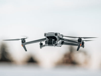
Real estate drone photography is aerial property imaging created for real estate marketing. A camera drone captures photos, drone footage, and video from above, giving a bird’s-eye view of the house, grounds, and nearby features. Unlike traditional photography, which focuses on eye-level rooms, façades, and interiors, drone photography can show how the property sits on the plot and what surrounds it. That broader context is often what helps potential buyers understand a listing faster. In practice, drone real estate photography is used to create clean overhead images, sweeping approach shots, and short promotional clips that support brochures, portals, and social posts.
Why Drone Photography Matters for Property Marketing
Aerial images help a listing stand out in a competitive market because they instantly add scale and context. A strong set of drone photos can show property size, layout, landscaping, access routes, and the surrounding area in one glance. For buyers comparing several homes online, that extra clarity can move a listing from “maybe” to “worth a viewing.” Drone real estate photography also supports real estate marketing by making the whole presentation feel more complete and more polished. Better visuals often attract faster interest from potential buyers, especially when the home has a distinctive plot, strong exterior features, or an attractive location.
Showcase Property Features
Some property features are difficult to appreciate from the ground, no matter how good the traditional photography is. Overhead drone photos make yards, pools, driveways, roofs, gardens, and boundary lines much easier to understand. A buyer can see whether outdoor space is practical for family use, whether access feels generous, and how much privacy the property offers. That kind of view is especially useful where the exterior is a key part of the decision, because it turns a vague listing detail into something visible and easy to judge.
Improve Real Estate Marketing Results
Drone real estate photography can raise engagement on listing pages because the images feel more informative and more premium. When a buyer can quickly understand the setting, the enquiry is often better qualified, since the property has already answered a few basic questions. That usually helps real estate agents spend less time on casual interest and more time with serious prospects. Luxury homes, large lots, and unique locations benefit most, but even mid-market listings can gain appeal when the visuals are clear, well framed, and consistent with the rest of the marketing.
When to Use Real Estate Aerial Photography
Real estate aerial photography is most effective for homes with large lots, waterfront settings, acreage, new developments, and properties where the exterior setting is a selling point. It also works well for homes near parks, golf courses, coastlines, or other visible landmarks. If the lot is compact and the property is mainly sold on interior features, aerial shots may be less important and should not overpower the listing. In those cases, interior photography should lead, with drone images used selectively for context rather than as the headline feature.
How Much Drone Real Estate Photography Costs
Pricing for drone real estate photography usually falls into three patterns: flat-rate packages, hourly billing, or bundled services that combine stills and video. Flat rates are common for standard residential jobs because they are easy to budget. Hourly pricing can suit larger or more complex shoots, while package pricing often works best when agents want photos, drone footage, and edited clips together. Final cost depends heavily on property size, location, and deliverables. A simple exterior shoot costs less than a full package with editing, video, and licensing for multiple uses. In the UK, travel distance and site complexity can also shift the quote.
| Pricing model | Best for | Typical trade-off |
|---|---|---|
| Flat rate | Standard listings | Simple budgeting, fewer custom options |
| Hourly | Large or variable shoots | Flexible, but less predictable total cost |
| Package pricing | Marketing bundles | Better value, but may include services not needed |
Drone video, editing, and licensing can push prices up because they add production time and wider usage rights. That is often worth paying for when the listing needs stronger presentation across portals and social media.
Typical Pricing Factors
The biggest variables are photographer experience and equipment quality. A skilled operator with a reliable camera drone and stable workflow may charge more, but the results are usually cleaner and more consistent. Property size, shot count, and turnaround time also matter: a larger site takes longer to cover, and next-day delivery tends to cost more than standard editing. Weather, travel, and insurance can influence quotes as well, especially when the job is remote, time-sensitive, or dependent on a short filming window.
How to Compare Quotes
When comparing providers, look beyond the headline price. Check what deliverables are included, how many edits are allowed, and whether usage rights cover marketing platforms, portals, and paid promotion. The cheapest quote may leave out useful extras such as drone footage, retouching, or faster delivery. It also pays to review portfolios before approving any drone photography service, because quality in real estate marketing is often visible in the composition, not just the camera spec.
Best Practices for Better Drone Photos and Video
Good aerial work starts before the drone leaves the ground. Planning the property angles, choosing the right time of day, and composing each frame carefully all affect the final image quality. A strong set of drone photos should do more than look impressive; it should tell a buyer where the home sits, how the grounds relate to the building, and what nearby features matter. For drone footage, smooth movement is just as important as sharpness. Steady passes and controlled turns produce polished video that feels professional rather than rushed. Variety helps too, because one overhead image rarely gives the whole picture.
Plan the Shoot Carefully
Start by reviewing the property layout and identifying the strongest angles. A corner plot, long driveway, rear garden, or sea-facing elevation may each need a different approach. Weather and sun position matter as much as the drone itself, since harsh shadows or flat light can weaken the result. Local flight conditions, nearby obstacles, and access points should also be checked in advance. That preparation saves time on site and reduces the chance of missing the one angle that best shows the listing’s strengths.
Capture the Right Shot Mix
The most useful shoots usually combine overview shots, close passes, and context images. Overview shots show the full property size, close passes highlight architecture and grounds, and context images explain the relationship to the surrounding area. Multiple angles make the listing story easier to follow, especially when the home has a distinctive layout or unusual setting. Buyers tend to make faster sense of a property when the imagery answers practical questions instead of repeating the same view.
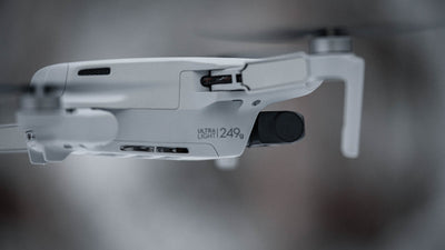
Equipment and Licensing Basics
A reliable camera drone and a stable gimbal are essential for clean results, because shake and poor control are obvious in aerial photography. Good image quality, solid flight stability, and enough battery life to complete the route all matter. Obstacle avoidance is particularly useful around trees, chimneys, and tight residential spaces where careful movement is needed. Commercial drone work may also require certification and insurance, depending on the country and the type of job. For real estate agents, that means choosing a provider who can operate legally, safely, and with the right cover in place.
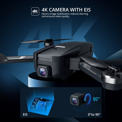
What to Look for in a Camera Drone
At a basic level, look for strong image resolution, stable flight, and easy control. A high-quality 4K ultra HD camera helps produce cleaner marketing images, while flight stability improves framing and reduces blurry results. Obstacle avoidance adds another layer of confidence when working around buildings, hedges, or mature trees. Features such as GPS enabled positioning and return to home function are also useful for safe, predictable operation, especially on jobs where accuracy matters more than speed.
Rules, Safety, and Insurance
Legal requirements vary by country and commercial use case, so the operator should always follow the local rules for airspace and safety. That includes checking no-fly zones, maintaining safe distances, and respecting privacy around neighbouring properties. Insurance is worth asking about because it protects both the professional and the client if something goes wrong. For commercial real estate photography, that peace of mind is part of the service, not an optional extra.
Editing Drone Footage for Real Estate Marketing
Editing turns raw aerial captures into marketing-ready assets. Colour correction can make a grey sky cleaner and greenery more natural, while sharpening and exposure adjustment improve clarity. Video should be trimmed to remove unnecessary movement, and the strongest drone photos should be chosen for the final set rather than uploading everything. Small distractions can also be removed where appropriate, which helps the listing feel more polished. Well-edited content makes the property look more professional and more trustworthy, which matters when buyers are comparing several similar homes online.
How to Choose a Drone Real Estate Photography Provider
Portfolio quality is the first thing to check, but it should not be the only thing. Look for pricing that is clear, turnaround times that match the listing schedule, and deliverables that are spelled out before booking. Real estate experience matters more than general drone experience because property marketing has its own visual rules: the work needs to flatter the listing without misrepresenting it. Communication is equally important. A reliable provider should confirm what will be shot, how the files will be delivered, and how revisions are handled if something needs adjusting.
Common Questions About Drone Real Estate Photography
Many sellers and agents want to know whether aerial work is genuinely worthwhile, which properties benefit most, and whether drone footage should replace standard images. The short answer is that drone real estate photography adds value when the property has land, setting, or exterior features worth showing. It is not a universal must-have, but it can strengthen a listing when the visual story matters.
Is Drone Photography Worth It?
For many listings, yes, because it improves visibility, makes the property easier to understand, and often lifts buyer interest. The return depends on the property type and the listing goals. A modest flat may not need much aerial coverage, while a house with a large garden or striking location can benefit noticeably. The best use of budget is usually the one that supports the marketing angle most clearly.
Does Drone Photography Replace Standard Photos?
No. Aerial and ground photos do different jobs. Drone photos show scale, setting, and layout, while standard images cover interiors, finishes, and room flow. The strongest listings use both. Drone real estate photography complements traditional photography rather than replacing it, giving buyers the context they need before they book a viewing.
Choosing the Right Aerial Approach for Listings
The most effective property marketing rarely depends on one image style alone. Real estate drone photography works best when it supports the listing’s main sales points, whether that is land, location, layout, or a distinctive exterior. If the property story is clear, the visuals should reinforce it; if the story is weak, aerials will not fix that on their own. For agents and sellers, the practical goal is simple: use drone photography where it adds clarity, compare providers on value rather than price alone, and make sure the final images help potential buyers understand why the property deserves attention.
Leave a comment